What We Do
Protect water quality, habitat and natural
resources in our urban watershed
The MWMO encompasses 25,309 acres (39.5 square miles) of fully developed urban lands and waters. We partner with our member communities to invest in green infrastructure that captures, cleans and reuses stormwater runoff.

Sacred Water Shared Future
In 1926, the Mississippi River was declared dead. A century of collective action brought it back.
River of Ideas Podcast
Check out our official podcast, focused on the big ideas around cleaner water and greener cities.

Watershed Basics
Learn how stormwater runoff impacts water quality and how watershed organizations help.

Stewardship Fund Grants
Designed to support efforts by the community to protect and improve water quality.
Projects
What We’re Working On
-
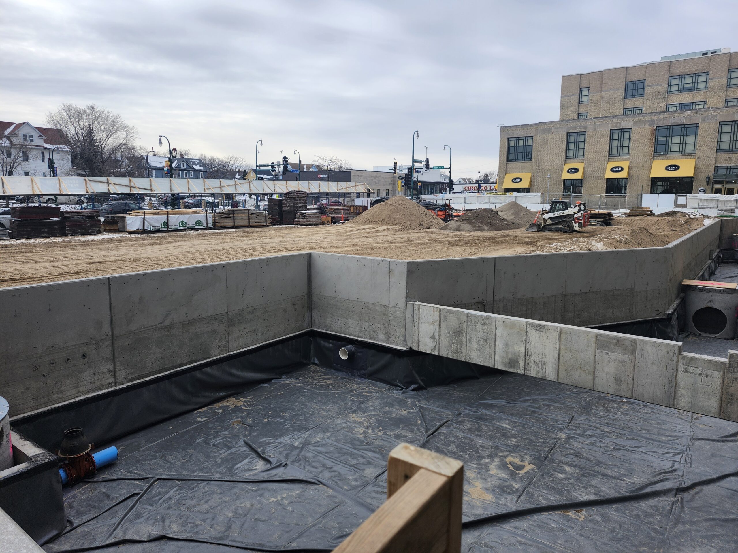
One Southside Green Infrastructure and Healthy Habitat
Southside Community Health Services is developing One Southside, a new health campus along a busy corridor in a Minneapolis Green Zone. Grant funding from MWMO will provide a signature water
-
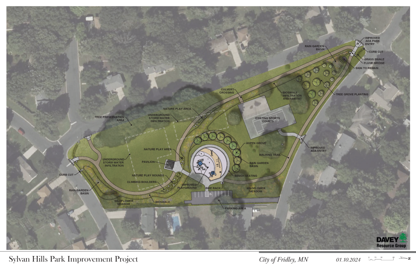
Sylvan Hills Park Regional Treatment
An MWMO grant is funding the installation of significant surface and underground green stormwater infrastructure in Sylvan Hills Park in Fridley as part of a total park redesign. These features
-
CW Lofts Sustainable Site Plan Implementation
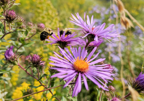
Turf grass replacement and a rain garden at CW Lofts enhance pollinator habitat, water quality, and green space in the heart of an industrial neighborhood.
-
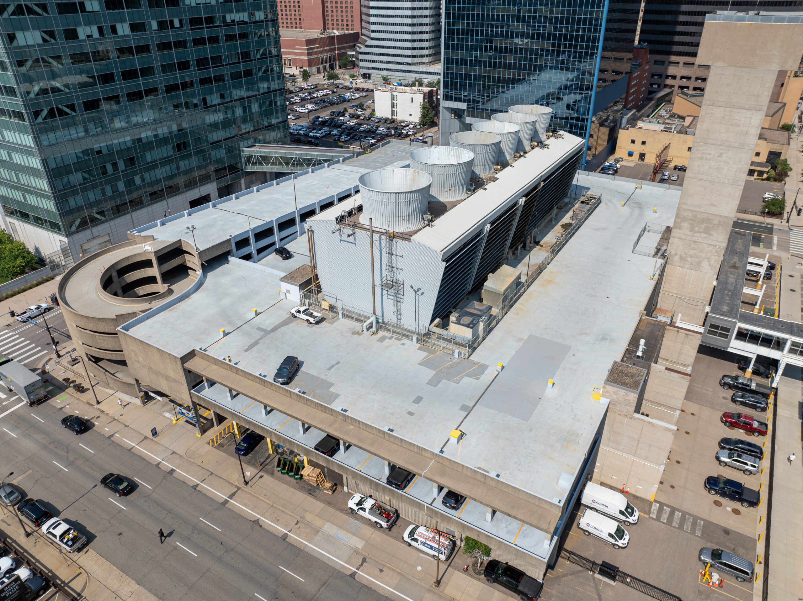
Cordia Energy Process Water Reuse
Wastewater generated from energy production will become a usable resource for watering and maintaining trees and greenery in downtown Minneapolis.
-
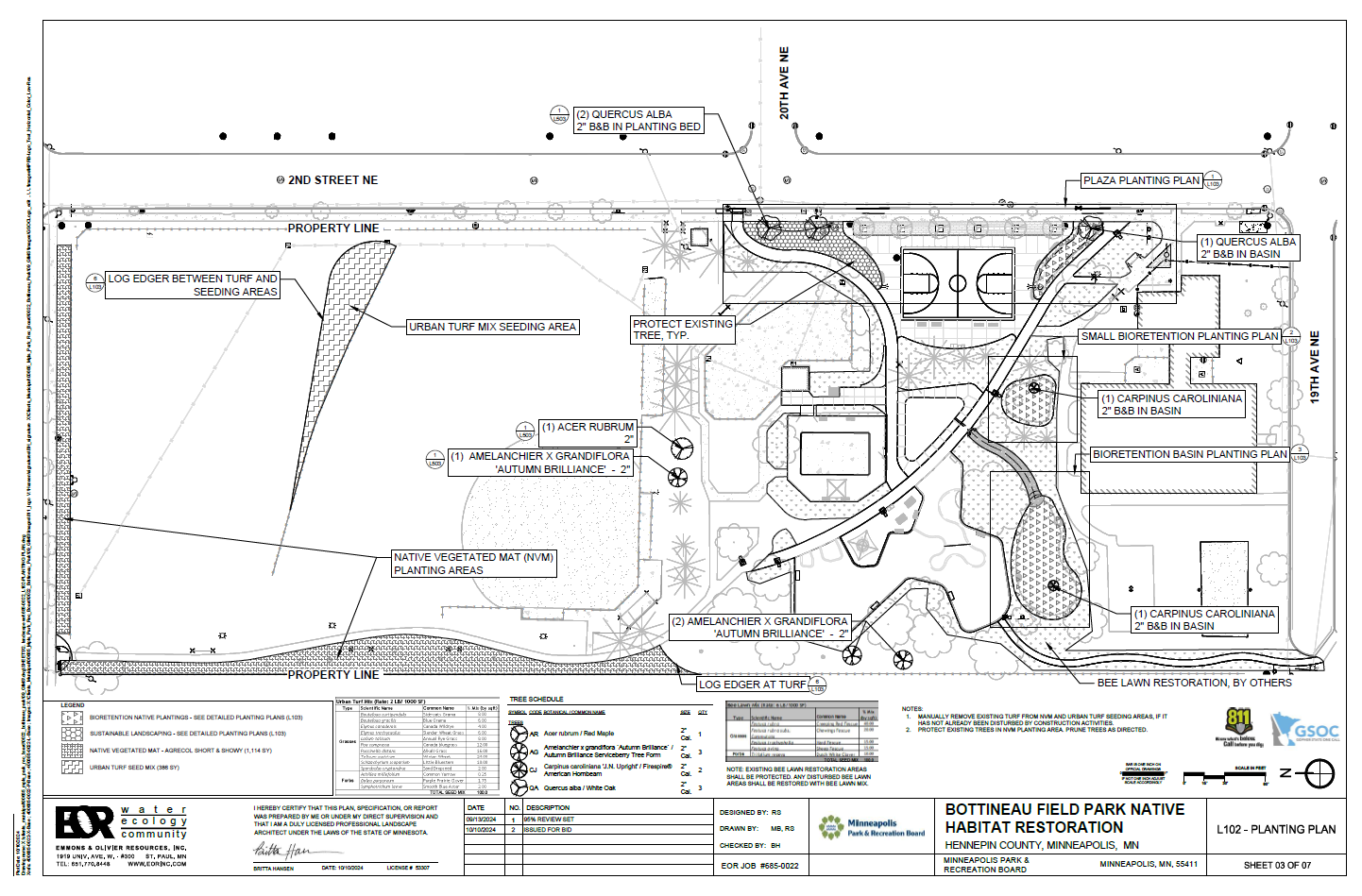
Bottineau Field Park
Bottineau Field Park in Northeast Minneapolis will undergo a 2025 renovation adding new amenities, walking paths, native habitat, and green stormwater infrastructure to support water quality, pollinators, and community environmental awareness.
-
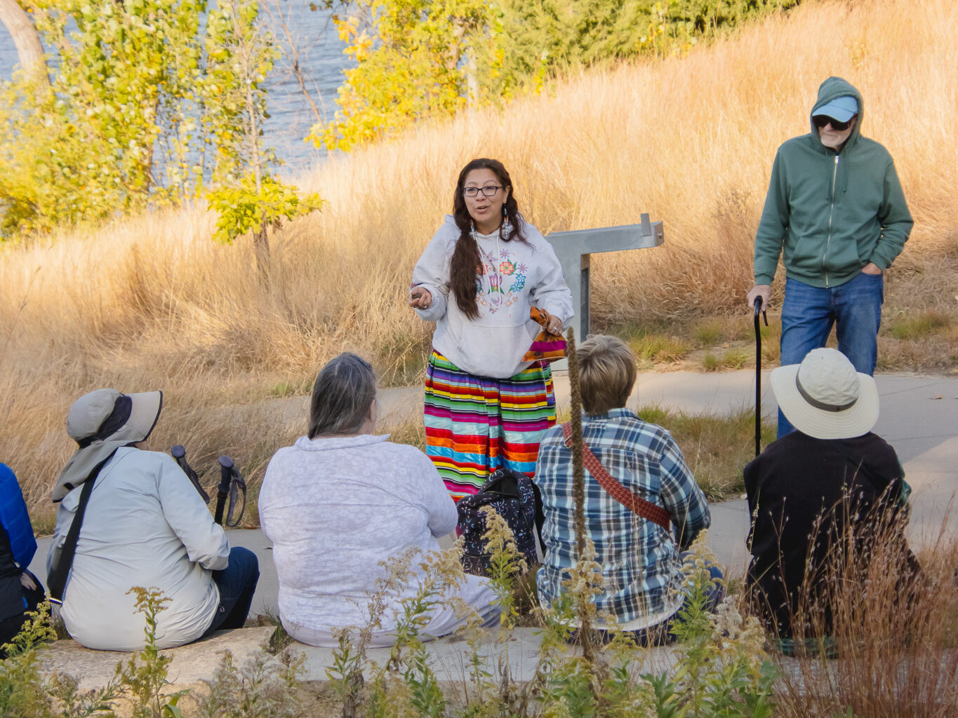
Honoring Native Plant Relatives: Dakota Plant Walks
A grant to Hennepin History Museum funds a series of plant walks led by Dakota and Anishinaabe storyteller and artist Tanáǧidaŋ Tó Wíŋ (Blue Hummingbird Woman or Tara Perron).
MWMO Watershed
Where is the Watershed?
Submit your address to find out if you’re in the MWMO’s watershed.
Latest News
Keep Up With The MWMO