News / March 08, 2018
Three graphs that show how melting snow carries chloride into our waterbodies


March is here, which means snow-melt, more snow and (hopefully soon) more snow-melt. Last week, with the warmer temperatures during the day, you probably noticed the snow piles in your neighborhood slowly shrinking. The MWMO monitoring team has been tracking that snowmelt as it moves from yards, streets, and sidewalks and into the stormsewer system.
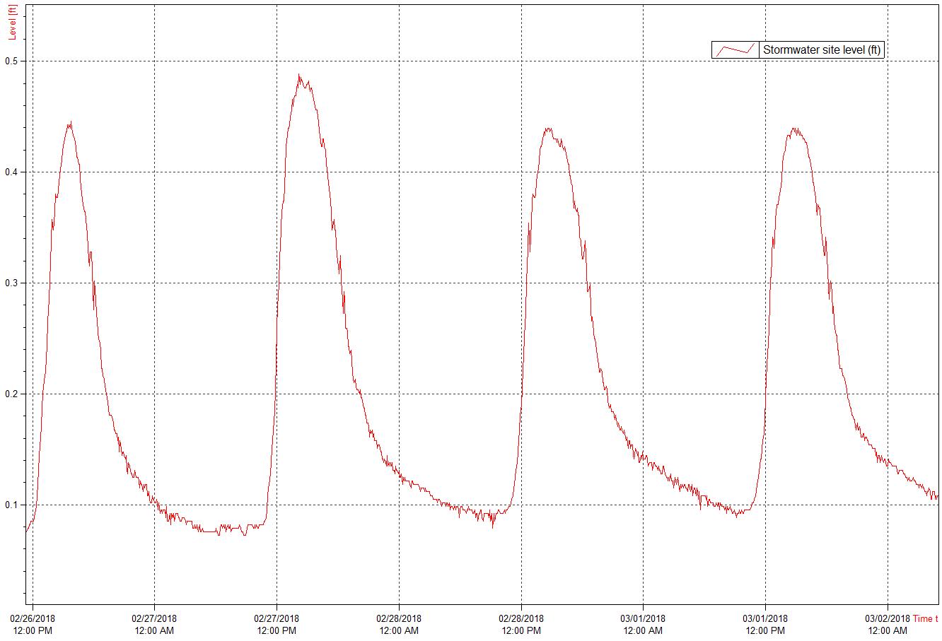
In several large stormwater pipes throughout our watershed, we use sensors (like this one) to monitor the level and velocity of water that flows through the pipe and eventually discharges to the Mississippi River. Last week, we were able to see the daily fluctuations in level within the monitored pipes as the temperature rose in the afternoons, melting the snow and sending the meltwater into the stormsewer system.
In addition to level and velocity, we also monitor the quality of the water moving through the stormwater system by collecting and analyzing stormwater samples. During the winter and spring, one of the primary pollutants we are interested in is chloride.
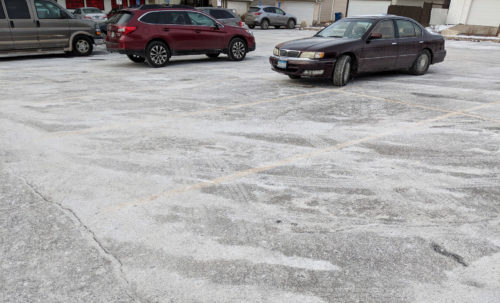
Chloride comes from the road salt and deicing chemicals that are used on our streets, sidewalks and other paved surfaces in the winter. When used properly, these chemicals can help keep ice off of these surfaces; however, we pay a hefty environmental price for it. When the snow melts in the spring, the water carries all of that salt into storm drains, through the stormsewers and into nearby waterbodies. Chloride can be toxic to aquatic wildlife, and is practically impossible to remove from a waterbody once it’s there. In high concentrations, it can be harmful to humans, and can even wreak havoc on drinking water supply infrastructure, as happened in Detroit.
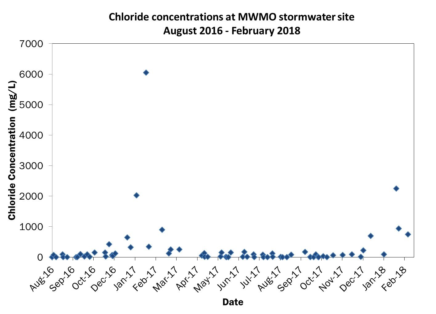
The graph below shows chloride concentrations over the last couple of years at a stormwater outfall monitoring site (the same one as in the first graph). As you can see, chloride concentrations are significantly elevated in the winter and spring month samples compared with those collected during the rest of the year. This seasonal pattern occurs at all of the stormwater sites monitored by the MWMO water quality monitoring team.

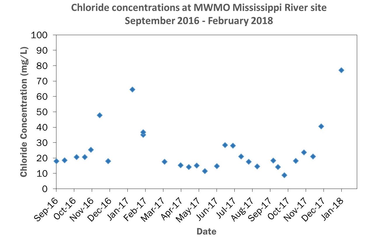
In the MWMO’s watershed, this salty stormwater drains directly into the Mississippi River. As it flows into the Mississippi, the polluted stormwater mixes with the river water and becomes diluted. Even so, elevated chloride concentrations in the river can still be seen during the winter months.
The graph below shows chloride concentrations in water samples taken during the course of nearly two years at the MWMO’s farthest upstream river monitoring site. Due to the sheer volume of river water, these chloride concentrations are below the MPCA’s chronic chloride water quality standard of 230mg/L. However, it’s important to remember that all this chloride travels downstream, where it becomes someone else’s problem.
Moreover, salty water doesn’t just drain to the river. It also goes into Twin Cities metro area streams, lakes and wetlands — some of which are already impaired, and which are becoming so polluted with chloride that their ability to support aquatic life might be in jeopardy.
We can all look forward to longer days and warmer weather as we move into spring, but remember: As the snow and ice from Monday’s winter storm begin to melt, salty, sediment-laden runoff will be flowing steadily into our waterbodies. Remember to use salt wisely and help prevent chloride from entering and impacting our streams, lakes, wetlands and the Mississippi River!
(Top photo of MnDOT snow plow courtesy Minnesota Pollution Control Agency.)
