After Hurricane Harvey, time to plan for a changing climate?

- Share on:
-

-

-

-

-


It’s not everyday that arcane subjects like land use and zoning find their way into the national news cycle, but these are extraordinary times. The flooding that followed in the wake of Hurricane Harvey sparked a vigorous debate about how much of the damage in water-logged Houston might have been avoided. Specifically, many argue the city should have done more to reign in its rapid, unchecked growth, which made it more vulnerable to catastrophic flooding.
Much of this debate has taken the form of finger-pointing. Some blamed Houston’s lax zoning laws for encouraging development in the city’s floodplains. (Others dismissed this argument.) Various reports also singled out the effects of climate change and local officials’ track record of climate denial as making it harder for the city to effectively plan for its infrastructure needs.
Blame-casting aside, the question of how well our infrastructure is able to cope with extreme weather is one that begs our urgent attention. Houston is not unique. If the science is right on climate change — and in Minnesota, this looks increasingly to be confirmed — we’re all looking at a future with more rain and more extreme weather events.
Unfortunately, our cities have not been designed to accommodate the increased average rainfall and more frequent “Mega Rain” events that we are now experiencing as a result of climate change. If these trends continue, and if we don’t find ways to adapt, we face a future in which ever-intensifying storm events threaten to continually overwhelm our civil infrastructure.
So, how did we get here, and how can we adapt and make our cities more resilient?
To be clear: Hurricane Harvey dumped an unprecedented 50 inches of rain on Houston; the city was going to flood, no matter what. But for those of us fortunate enough to be outside the reach of hurricanes and tropical storms, the impacts of climate change still pose a serious dilemma about how to plan for the future.
Setting new standards?
It’s important to understand how things like stormwater infrastructure are designed. Engineers design stormwater systems to meet a certain standard. For most communities, the accepted standard is a 10-year storm event. This means that the city’s storm drain systems have the capacity to manage a rainfall large enough that, in any given year, it has just a 1-in-10 chance of happening. Anything bigger than a 10-year storm event, however, and the system could become overwhelmed.
This begs an obvious question: Why not plan stormwater infrastructure to a greater standard, like a 100-year or even a 500-year event? The answer, to put it bluntly, is that it’s usually not practical. Investments in infrastructure are subject to the law of diminishing returns. The cost of building and/or retrofitting stormwater infrastructure to accommodate near-apocalyptic levels of rain would be prohibitively expensive. It would also be a logistical and political nightmare, and could run into conflict with other legitimate city goals like economic development.
So what’s the right standard, then? At what point do planners throw their hands up and declare, “Look, we can’t add more capacity than this. It’s going to flood at some point.”
That’s the big question. We don’t know the answer yet, but it would help if we had better data to work with. Here at the MWMO, for example, we’re in the middle of a years-long process of developing detailed computer models of our watershed. These models will help us better understand and predict what will happen during storm events. For each subwatershed inside our boundaries, two different types of models are being created: a hydrology and hydraulics (“H&H”) model helps us understand the volume and velocity of stormwater flow during storm events, while a water quality model indicates likely sources and amounts of pollution coming off the landscape.
Models aren’t perfect, but they’re a starting point. The better the information we have to work with, the more likely we are to plan successfully for our future needs. Our goal in creating these models is to help target our stormwater projects to be as effective as possible. But they can also be used by our member cities to help plan improvements to stormsewers and best management practices (BMPs).
On a broader scale, new climate models will have to be taken into account as cities look at updating their infrastructure. The question of just how much rainfall our local stormwater systems should be able to withstand is one that will be hotly debated as the climate gets wetter.
In the meantime, we have another question to ponder: How do we adapt to the new normal?.
New thinking vs. retrofitting old systems
As cities adapt to climate change, they’ll have a choice to make. Do they try to retrofit their current systems to add more capacity, or do they find new and innovative ways to manage stormwater runoff? The answer might be a bit of both.
In 2015, the Minnehaha Creek Watershed District released a report detailing the growing number of extreme rainfall events in Minnesota and outlining the risks for communities that don’t adequately plan for and adapt to a changing climate. The researchers examined various “adaptation pathways” for mitigating the risk of increased flooding at two specific sites in Minneapolis and Victoria.
The report concludes that while some local stormwater systems would hold up adequately under increasing rainfall scenarios, others would not. Replacing old stormsewer pipes with larger ones would likely be necessary in some areas. However, the researchers also found that a supplemental strategy of low-impact development would provide a “significant reduction in adaptation costs.”
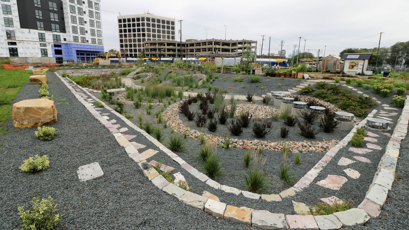
Low-impact development uses techniques that filter, store, evaporate and infiltrate stormwater runoff on site, rather than sending it through the local stormsewer system. Rain gardens, swales, stormwater reuse systems, and permeable pavements are all examples of low-impact development practices.
Many of the MWMO’s projects involve low-impact development practices that create opportunities to capture, treat and reuse stormwater runoff. Our primary goal with these practices is to improve water quality in the Mississippi River. But they can also be used to help reduce the risk of flooding.
Here’s an example: smartphone footage showing what happened when the street in front of our building flooded in 2015. All the excess runoff from the street was captured in our various stormwater BMPs.
I should clarify that controlling flooding isn’t usually our issue at the MWMO. For the most part, that job falls under the domain of our member cities. They’re the ones who own the local stormwater infrastructure, and they set the standards that developers must follow to manage stormwater runoff on their properties. The MWMO’s projects are intended to go above and beyond the city requirements, for the purpose of protecting and improving local water quality.
Low-impact development can’t solve everything. But as the Minnehaha Creek study shows, it is a reasonable, effective and cost-efficient way to supplement traditional stormwater infrastructure. We believe communities need to consider these options as part of the mix moving forward.
These debates aren’t going away. As of this writing, one of the most powerful Atlantic hurricanes ever recorded is pummeling the State of Florida. Another round of historic flooding will be followed by more debate about whether and how to make our communities more resilient in the face of extreme weather events.
In the case of Houston, the city’s rapid urban sprawl may not have caused the flooding, but it certainly made the destruction much worse than it might have been. As Minnesota moves into an era of climate change and more extreme rainfall, we must ask the question: Will we make the same mistake?
Top photo by Daniel J. Martinez, U.S. Air National Guard.
- Share on:
-
-
-
-
-