News / January 16, 2020
Story Map Tool Reveals the Hidden Journey of Stormwater Runoff to the Mississippi River


One of our most persistent challenges at the MWMO is helping people understand the direct connection between themselves and the Mississippi River. Most Minnesotans care about clean water — at least in the abstract — but few realize the impact that their own communities have on water quality.
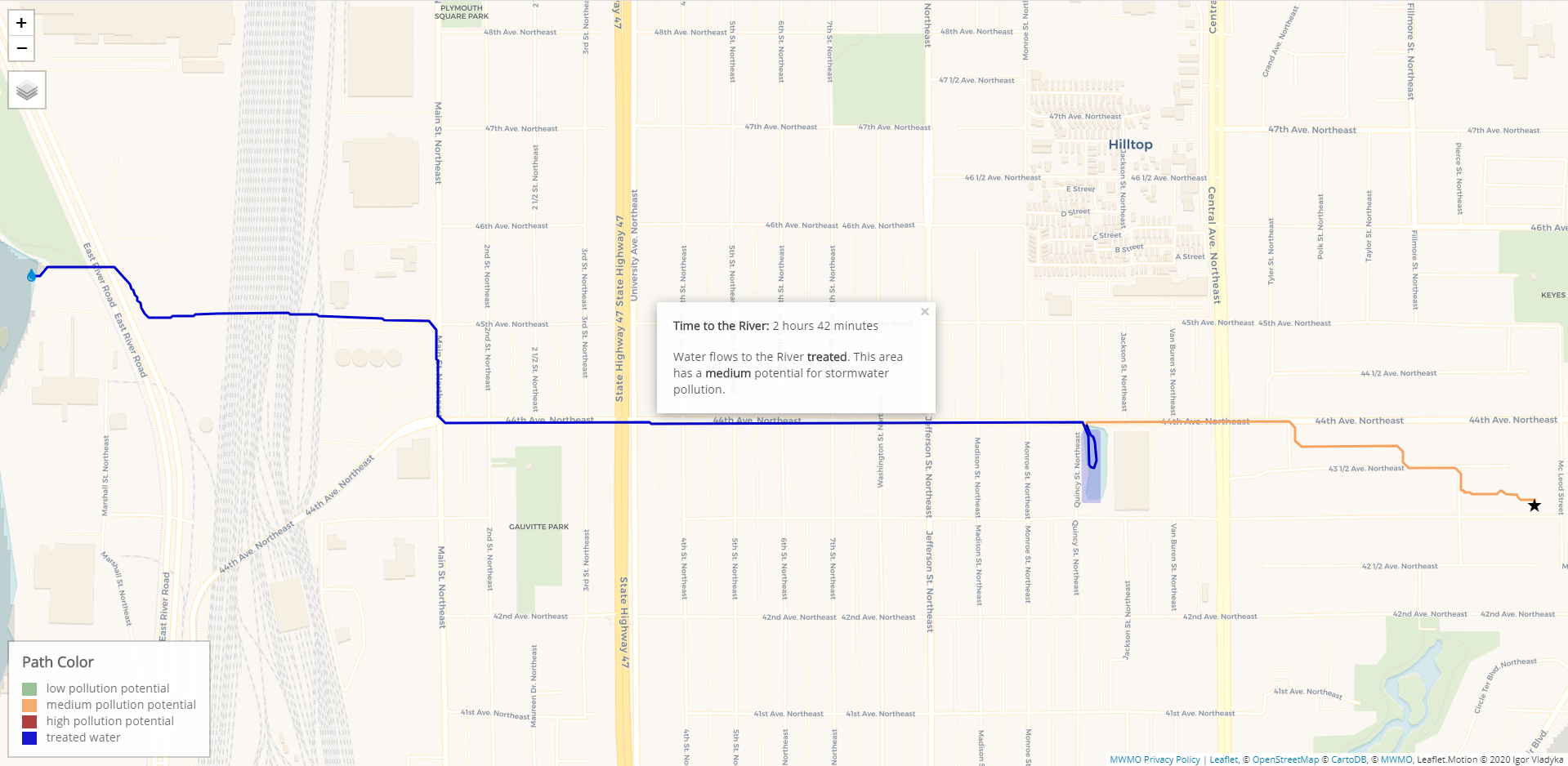
In our watershed, most stormwater runoff gets piped directly into the Mississippi River; it generally gets there quickly, and it is not treated to remove pollutants first. But how do you show this to people when most of it is occurring underground, via the stormsewers? What if you had a tool that could show people exactly how the water flows from their street into the river — the path it takes, how fast it moves, and the amount of pollution it carries?
Residents of our watershed can now do that with our new Path to the River application. The web-based tool allows users to click on a geographic location in our watershed and trace the path that stormwater takes from that point into the Mississippi River. In addition to showing the route that runoff takes through the stormsewers, the application also shows the amount of time it takes to reach the river and the relative amount of pollution it will likely carry with it. If that runoff is being captured and cleaned by a known stormwater best management practice (BMP), the map will show that too.
The Path to the River application is also part of our new Story Map, which will be incorporated into our website later this year. The Story Map highlights how our changing landscapes impact water quality, and showcases the MWMO’s water quality monitoring program and green infrastructure projects. (The Path to the River tool inside the story map is slightly different from the main tool, focusing mainly on whether or not the runoff is being treated.)
Both the application and the Story Map display results of an important watershed modeling project, which is actively developing comprehensive models for all of the MWMO’s subwatersheds. Using these models, the MWMO and its partners are able to understand and predict the flow of stormwater runoff and the amount of pollution that is generated during storm events. This information helps us target our stormwater projects so as to maximize their cost-efficiency and the amount of pollution and flooding they reduce.

Turning Modeling Data into an Educational Tool
The new Story Map and Path to the River tool are updated versions of a pilot Story Map application we developed three years ago in partnership with Barr Engineering. The centerpiece of that Story Map was a “travel time application” that used modeling data to reveal the amount of time it takes for stormwater to flow from points around our watershed to the Mississippi River (where nearly all runoff flows from within our watershed).
This first version of the Story Map only covered one MWMO subwatershed, “11CHF,” which comprises portions of Columbia Heights and Fridley as well as all of Hilltop. With the new, updated version, we wanted to expand the application to cover a much larger area, as well as provide more information about how the runoff was actually interacting with the landscape on its way to the river.
Last year, we partnered with the University of Minnesota’s U-Spatial Group to expand the original Story Map application. Whereas the original Story Map showed only the path of the runoff and the amount of time it takes to reach the river, the new version provides some additional information, including whether or not the stormwater is treated along the way (by a known stormwater BMP, such as the St. Anthony Regional Stormwater Treatment and Research System) and the relative potential for it to carry pollutants to the river. In addition, the tool now covers a much larger area of our watershed.
If you have a technical background, you might be wondering about the assumptions and the geographic data that underlie the tool. We’ve prepared a summary of the application’s development, with explanations of how we’re calculating flow paths, travel times, stormwater treatment, and pollution potential.
Later this year, we plan to integrate the Story Map into our website’s Stormwater 101 content. In the meantime, we’d love to hear your feedback! Take a look, play around with it, and tell us what you think.


